 Obstacles
in the rhine
Obstacles
in the rhineObstacles
in the rhine
|
|
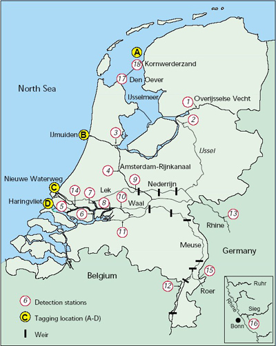 |
The map shows the places where seatrouts and atlantic salmon
where caught and tagged (A-D) during a survey of RIZA (Institute
for Inland Water Management and Waste Water Treatment) in the netherlands
called "Migration of seatrouts". The numbered places from 1 to 18 show the
location of radiodetection stations where the fishes where monitored during
their spawning migration . If you move the mouse over the map you find those obstacles that can be viewed |